| Switzerland & Austria | Europe |
|
Grande Dixence Dam PhotosFrom: Grande Dixence Dam
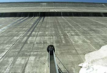
This is what you'll see when you stand at the dam's base and look up. (The round hole is an entrance to the dam's 32 km or 20 miles of tunnels and inspection shafts. On the right is a patch of snow from the previous winter; the photo was taken on a hot day in late June.)
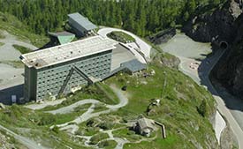
The Hotel du Barrage is at the base of the dam, above the parking lot, the aerial cableway, and the exhibition hall. It may look like a convention hotel, but it has only 72 guestrooms and a full-service restaurant. (The high-rise structure originally served as a workers' dormitory from 1961-1965, when the current dam was built.)
If you scramble up the hill behind the Hotel du Barrage, you'll come across a stone chapel that was built by workers in the 1930s, when the first Dixence dam or ancien barrage (now submerged in the Lac des Dix) was constructed.
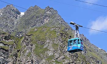
From a station near the hotel, a télépherique or aerial cablecar lifts visitors from the base of Grand-Dixence to the top of the dam's 285-meter wall.
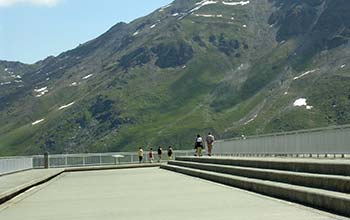
This picture gives an idea of the Grande Dixence Dam's scale. The top of the wall is the skinny part of the dam--it's only 15 meters or about 50 feet thick, compared to a depth of 200 meters or 656 feet at the base. There's enough concrete in the Grande Dixence Dam to build a wall 1.5m or 5 feet high, 10 cm or 4 inches thick, and 40,000 km or nearly 25,000 miles long, which is roughly the earth's circumference at the Equator.
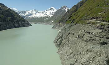
Behind the Grande Dixence Dam, the Lac des Dix extends some 4 km or 2.5 miles into the Val des Dix. The lake is fed by glaciers and by pumping stations in adjacent valleys, which send water to the Lac des Dix for storage during times of excess generating capacity. The water in the lake represents enough stored electrical energy to power the entire canton of Berne, Switzerland year-round. (To use another statistic, the Grande Dixence Dam and its generating plants are capable of meeting one-fifth of Switzerland's power requirements.)
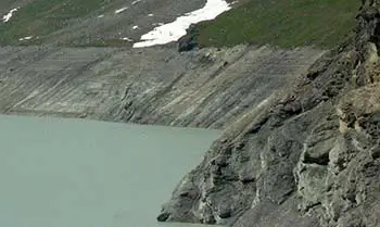
The vegetation-free strip on the lake's banks indicates the maximum water depth. The Lac des Dix reaches its lowest level in spring; in summer, as glaciers melt, the lake fills up. The lake is normally at its deepest in September. Interesting facts:
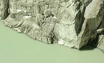
If the sight of all that water makes you thirsty, don't dip your canteen into the lake: It's fed by glaciers, and the suspended rock particles in the water will erode your innards. The water is so abrasive that turbine blades in the hydroelectric plants downstream must be replaced every one to two years.
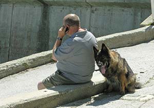
The top of the Grande Dixence Dam may seem remote, but you can use your mobile phone, and about 100,000 people visit every year (some with their dogs).
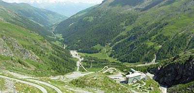
Views from the Grande Dixence Dam are spectacular: This panorama looks toward the Val d'Hérens and the mountains beyond. (The Hotel du Barrage and chapel are just vissible near the bottom of the photo.)
When you've had your fill of breathaking views, you can follow marked walking paths into the protected nature areas around the dam. (Wear sturdy hiking shoes and carry a map.)
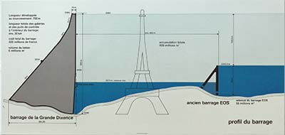
Finally, before heading back down, take a moment to study the architectural plans and diagrams on the wall next to the télépherique station, where you'll also find public toilets. This diagram shows that the Grande Dixence Dam is nearly as high as the Eiffel Tower. The small dam on the right side of the drawing is the ancien barrage or old dam that was built in the 1930s and is now submerged in Lac des Dix. Back to: Grand Dixence Dam |
|
|
| Europe for Visitors - Home | | Contact information, disclosures, audience | Copyright © 1996-2024 Durant and Cheryl Imboden. All rights reserved. |