Canals in France
Printed Maps and Guides
From:
A Barge Cruise in France
If
you're going on a barge cruise or renting a boat in France, the following maps
and guides may be useful:
 |
Welcome to Voies navigables de France (VNF, the
French inland waterways network is a free brochure/map from the
French government that shows rivers and canals throughout the country.
It also has addresses and other practical information in English. We
received a copy of this map with our European Waterways Ltd
cruise documents. You can also pick it up at local tourist offices along
the waterways. |
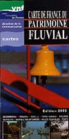 |
VNF Carte de France du Patrimoine Fluvial
is another free map, but in a larger format than the brochure described
above. On the back, it has photos, cutaway illustrations, etc. with
waterway-related trivia in French. This map may no longer be in print;
we obtained a three-year-old edition at the Montargis tourist office. |
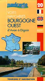 |
Navicarte Voies Navigables: Tourisme et
Navigation is a series of maritime road atlases for boaters and
barge operators. Volume 20, "Bourgogne Ouest d'Avon à Digoin," includes
the Canal de Briare and the Canal du Loing (which were on our La
Renaissance itinerary). Navicarte publishes 28 detailed map guides
(such as the one above), four regional map guides, and two general
country maps--one for France, and one for Belgium.
The detailed map guides cost a whopping €25, but they're
indispensable if you're a boater, and they do make useful souvenirs.
Look for them at French ship chandlers and map shops, or order them from
Stanfords in London. |
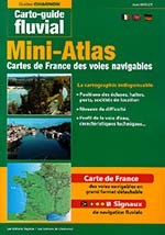 |
Carto-Guide Fluvial Mini-Atlas, from Guides
Chagnon, is a handy maritime atlas that shows rivers and waterways
throughout France. It also has a large folded map that you can pull from
the binding to consult or mount on the wall. The Mini-Atlas's maps
aren't as detailed as those in the Navicarte guide shown above, but the
book is useful is a general planning resource. (We bought our copy from
a ship chandler in Saint-Mammès on the Seine; the price in 2008 was
€
20.) |
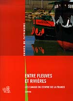 |
Entre Fleuves et Rivières: Les Canaux du Centre
de la France is a book of photos and text (in French) that makes
a great souvenir of a barge cruise or boat trip the canals and rivers of
the Loire Basin. The price when we last checked was €25. (We purchased our copy at
a bookshop in Montargis.) |
For more information on canal
maps and guides, visit these French-language Web sites:
| |
|