|
|
| Venice Home | All topics |
| Where to stay | Transportation |

|
|
Lido Layout and OrientationFrom: Lido di Venezia (Venice Lido)
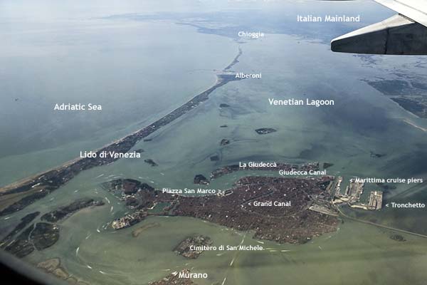
ABOVE: The Lido di Venezia (on left) is a long island that protects the Venetian Lagoon from the Adriatic Sea. The Lido is only a short distance by water bus from the Piazza San Marco and other landmarks in Venice's historic center.
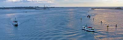
Two shipping channels mark the Lido's northern and southern boundaries: On the north (just to the left of the top photo), the Porto di Lido is used by smaller cruise ships and private yachts. To the south, by the village of Alberoni, the Porto di Malamocco connects with the Malamocco-Marghera ship channel, which is used by freighters, tankers, and large cruise ships on their way to the Marghera industrial port on the Italian mainland near Venice. BELOW: The Porto di Lido, with Punta Sabbioni on the left and the Lido to the right of the ship channel. The Adriatic Sea is in the distance, beyond the gap.
For a more detailed overview of the Lido, see our Lido Map, which is a Google satellite map that you can zoom and drag. Next page: Getting to the Lido
|
|
|
| Venice for Visitors - Home | | Europe for Visitors - Home | | About our site | | Press clippings | | Testimonials |
Disclosure: Where hotel or other reservation links point to third-party booking sites, we may receive a small commission on transactions. This will not affect the rate you pay. Copyright © 1996-2026 Durant and Cheryl Imboden. All rights reserved. |
 The
Lido di Venezia is a wide sandbar or barrier island that measures about 11 km (7
miles) long and 700 meters (less than half a mile) at its widest point. On its
eastern side (left in the photo above), it has a long series of beaches that
face the Adriatic Sea. The western waterfront faces the Venetian Lagoon, the
city of Venice, and the Italian mainland.
The
Lido di Venezia is a wide sandbar or barrier island that measures about 11 km (7
miles) long and 700 meters (less than half a mile) at its widest point. On its
eastern side (left in the photo above), it has a long series of beaches that
face the Adriatic Sea. The western waterfront faces the Venetian Lagoon, the
city of Venice, and the Italian mainland.
 Most of the Lido's hotels, restaurants, and shops are near the "Lido di
Venezia" label in the photo at the top of this page. The main commercial street, the
Most of the Lido's hotels, restaurants, and shops are near the "Lido di
Venezia" label in the photo at the top of this page. The main commercial street, the
 From
this street, you can easily walk over level ground to most places of
interest or to your hotel. (You can also take local buses, hire taxis, or
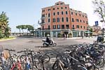
rent a bicycle or quadracycle if you prefer wheeled transportation: Unlike
central Venice, the Lido allows bikes, pedal cars, and motorized traffic.)
From
this street, you can easily walk over level ground to most places of
interest or to your hotel. (You can also take local buses, hire taxis, or
rent a bicycle or quadracycle if you prefer wheeled transportation: Unlike
central Venice, the Lido allows bikes, pedal cars, and motorized traffic.)