| Venice Home | All topics |
| Where to stay | Transportation |

|
Introducing VeniceAn orientation for first-time visitors
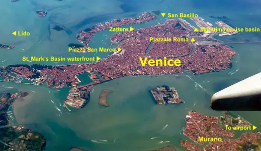
ABOVE: This aerial view of Venice, Italy has captions to help you get your bearings. The city's historic center is in the upper half of the photo, with the glassmaking island of Murano at lower right. Are you planning your first trip to Venice, Italy? If so, this brief introductory guide will make your task easier.
Basic geographyAs you can see from the photo above, Venice is an island city: The centro storico or historic center is a tightly-integrated cluster of 118 small islands that are linked by more than 400 footbridges. (Every time you cross a canal, you're stepping onto another island.) See "Is Venice connected to the mainland?" for more details and aerial photos. The entire city center covers only about 1,800 acres or 725 hectares, which is a little more than twice the size of New York's Central Park or London's Hampstead Heath. The centro storico or historic center of Venice is connected to the mainland suburb of Mestre by the Ponte della Libertà, a long causeway that was built early in the 19th Century.
To the right or east of the historic center is the Lido di Venezia, a long, narrow strip of land that separates the Venetian Lagoon (which surrounds Venice) from the Adriatic Sea. Picking the right hotel locationIn our "Picking the best hotel location" article, we make a statement that's worth repeating here:
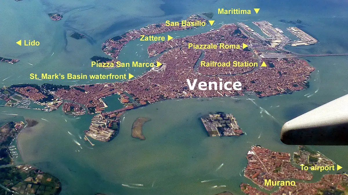
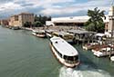
Many first-time visitors book hotels (or let their travel agents book hotels) without giving any thought to location. This can lead to frustrating and expensive mistakes. To see why, let's look at another aerial photo:
Let's say that you're arriving by air and spending two days in Venice before departing on a small cruise ship from the San Basilio pier. Your travel agent books you into a hotel in Castello, inland from the Piazza San Marco. You're traveling with large, heavy luggage. Because your travel agent knows a lot about cruising but very little about Venice, she didn't realize that:
You're going to have a frustrating experience that could have been avoided if you'd stayed at a hotel closer to your cruise terminal. The same principle applies if you're arriving and departing by train: By staying within walking distance of the Santa Lucia railroad station, you'll save time, hassle, and money. To find suitable hotels quickly and easily, see our Venice Hotel, B&B, and Apartments Guide.
Venice Transportation |
|
| Venice for Visitors - Home | | Europe for Visitors - Home | | About our site | | Press clippings | | Testimonials |
Disclosure: Where hotel or other reservation links point to third-party booking sites, we may receive a small commission on transactions. This will not affect the rate you pay. Copyright © 1996-2026 Durant and Cheryl Imboden. All rights reserved. |
 Important islands near the historic center are La Giudecca (separated from the centro storico by the Giudecca Canal, which is used by